MANCHESTER ESTATE PUBS
Drop Forge, Greenside Street
Drop Forge, Greenside Street, Openshaw. (c) D.N. at ManMates Facebook.
Bullcote, Hyde Road
Bullcote, Hyde Road, Denton. (c)
Pub Curmudgeon
.
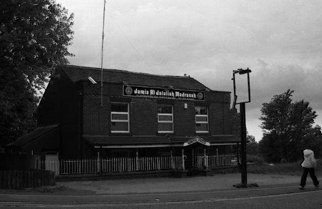
Hot Pot, Moss Side Precinct
Hot Pot, Moss Side Precinct, Moss Side. (c)
Manchester Local Image Collection
.
Squire, Wood Lane
Squire, Wood Lane, Partington. (c)
Trafford Council
.
Bobbin, Grey Mare Lane
Bobbin, Grey Mare Lane, Beswick. (c)
D.N. at ManMates Facebook
.
Anvil, Greenwood Road
Anvil, Greenwood Road, Benchill, Wythenshawe. (c) Alan Winfield with permission.
Longsight, Kirkmanshulme Lane
The Longsight, Kirkmanshulme Lane, Longsight. (c)
D.N. at ManMates Facebook
.
Greyhound, Manchester Road
Greyhound, Manchester Road, Partington. (c)
Messenger Newspapers
.
Penny Farthing, St Annes Road
Penny Farthing, St Annes Road, Denton. (c)
Mickaul
2010 at
panoramio
.
Three Bears, Jackon's Lane
Three Bears, Jackon's Lane, Hazel Grove. (c) Google 2012.
View Larger Map
.
Vernon Arms, London Road South
Vernon Arms, London Road South, Poynton. (c) Google 2012.
View Larger Map
.
Greyhound, Bowden Street
Greyhound, Bowden Street, Stockport. (c) Google 2012.
View Larger Map
.
Mosley Arms, Red Lane
Mosley Arms, Red Lane, Bolton. (c) Google 2012.
View Larger Map
.
Lancashire Lass, Meadow View
Lancashire Lass, Meadow View, Rochdale. (c) Google 2012.
View Larger Map
.
Horseshoe, Manchester Road West
Horseshoe, Manchester Road West, Little Hulton. (c) Google 2012.
View Larger Map
.
Lancastrian, Kenyon Way
Lancastrian, Kenyon Way, Little Hulton. (c)
deltrems
at flickr.
Kenyon Arms, Manchester Road West
Kenyon Arms, Manchester Road West, Little Hulton, 1990. (c)
deltrems
at flickr.
Brindley Arms, Whittle Street
Brindley Arms, Whittle Street, Walkden. (c) Google 2012.
View Larger Map
.
Tiger Moth, Swallow Drive
Tiger Moth, Swallow Drive, Irlam. (c) Google 2012.
View Larger Map
.
Flying Shuttle, Clerke Street
Flying Shuttle, Clerke Street, Bury. (c) Google 2012.
View Larger Map
.
Beaumont, Armadale Road
Beaumont, Armadale Road, Bolton. (c) Google 2012.
View Larger Map
.
Spinners, Brownlow Way
Spinners, Brownlow Way, Bolton. (c) Google 2012.
View Larger Map
.
New Crown, Jura Close
New Crown, Jura Close, Dukinfield. (c) Google 2012.
View Larger Map
.
Forester, Fir Tree Lane
Forester, Fir Tree Lane, Dukinfield. (c) Google 2012.
View Larger Map
.
Puss in Boots, Nangreave Road
Puss in Boots, Nangreave Road, Stockport. (c) Google 2012.
View Larger Map
.
Shady Oak, Redford Drive
Shady Oak, Redford Drive, Bramhall. (c)
Manchester Evening News
.
Primrose View, Ashton Road
Primrose View, Ashton Road, Oldham. (c)
Pubs for Let
.
Alpine Gasthof, Whitworth Road
Alpine Gasthof, Whitworth Road, Rochdale.
(c)
Ian S
at
geograph
under
Creative Commons
.
Flying Shuttle, Highfield Road
Flying Shuttle, Highfield Road, Farnworth. (c)
d
aily
m
ail
.
Summit, Rochdale Road
Summit, Rochdale Road, Royton. (c)
Virtual Tourist
.
The Ace, Fircroft Road
The Ace, Fircroft Road, Hathershaw. (c) Google 2012.
View Larger Map
.
The Haggate, Haggate
The Haggate, Haggate, Royton. (c) Google 2012.
View Larger Map
.
Moonrakers, Phoebe Street
Moonrakers, Phoebe Street, Ordsall. (c)
Salford Pubs of the 70s
at flickr.
Welcome Inn, Robert Hall Street
Welcome Inn, Robert Hall Street, Salford. (c)
Salford Pubs of the 70s
at flickr.
Jubilee, Tatton Street
Jubilee, Tatton Street, Ordsall. (c)
Salford Pubs of the 70s
at flickr.
Colliers Arms, Old Lane
Colliers Arms, Old Lane, Chadderton. (c)
therevolution962
.
North Star, Rushcroft Road
North Star, Rushcroft Road, High Crompton.
(c)
David Dixon
at
geolocation
under
Creative Commons
.
Nowster, Oldham Road
Nowster, Oldham Road, Middleton. (c) Google 2012.
View Larger Map
.
Bell Hotel, Manchester Road East
Bell Hotel, Manchester Road East, Little Hulton. (c) Google 2012.
View Larger Map
.
Seahawk, Bold Street
Seahawk, Bold Street, Hulme. (c) Richard Aldred at
BBC
.
Crown Inn, Ashton Old Road
Crown Inn, Ashton Old Road, Fairfield. (c)
deltrems
at flickr.
Smithy Bridge, Smithybridge Road
Smithy Bridge, Smithy Bridge Road, Smithy Bridge. (c) Google 2012.
View Larger Map
.
Old White Hart, Chadderton Way
Old White Hart, Chadderton Way, Oldham. (c)
Adam Brierley
at
closedpubs
.
Bay Horse, Parr Lane
Bay Horse, Parr Lane, Bury. (c)
David Dixon
at
City Local
under
Creative Commons
.
King George, Moss Lane
King George, Moss Lane, Hale. (c) Google 2012.
View Larger Map
.
March Hare, Crowhill Road
March Hare, Crowhill Road, Ashton-under-Lyne. (c) Google 2012.
View Larger Map
.
Guzzlin' Goose, Bentinck Street
Guzzlin' Goose, Bentinck Street, Ashton-under-Lyne. (c)
The Unforgiven
.
Pegs Tavern, St Albans Avenue
Pegs Tavern, St Albans Avenue, Ashton-under-Lyne. (c) Google 2012.
View Larger Map
.
Two Hundred, Carisbrook Street
Two Hundred, Carisbrook Street, Harpurhey. (c) Google 2012.
View Larger Map
.
Stumble Inn, Clegg's Lane
Stumble Inn, Clegg's Lane, Little Hulton. (c) Google 2012.
View Larger Map
.
Older Posts
Home
Subscribe to:
Posts (Atom)


